just wanted to share something so interesting I came across on Remember Singapore!
10 Common Misconceptions of the Names of Places in Singapore
Posted on June 16, 2013by Remember SingaporeIs Ang Mo Kio “ang mo kio” (tomato)? Or is Holland Village named after the Dutch community in Singapore? Are there any links between the new Chong Pang estate and the old Chong Pang Village? Let’s find out more…
1. Ang Mo Kio
Tomatoes are called “ang mo kio” (Caucasian’s brinjal) in Hokkien, which probably led to the misconception that the name of Ang Mo Kio New Town was named after the fruit. However, no tomato farms were ever recorded growing in the old Ang Mo Kio vicinity.
A more likely explanation of the name Ang Mo Kio was the bridge purportedly built by the British Government Surveyor John Turnbull Thomson (1821–1884), where the locals referred it as the “Caucasian’s bridge”. It was also said that there was not one but a total of nine bridges built along Thomson and Upper Thomson Roads, starting from the “red bridge” at Cavenagh Road and ending at the junction of Upper Thomson Road and Ang Mo Kio Avenue 1.
But for the time being, the tomato sculptures near the Ang Mo Kio Town Centre shall stay on.
2. Holland Road & Holland Village
Holland Village has one of the most common misnomers in Singapore, mistakenly thought to be named after the Low Country of Europe. Started off as a humble plantation village located at the junction of Holland Road and Buona Vista Road, the name Holland Village was proposed by the Singapore Rural Board in 1929. Holland Road, on the other hand, has been in existence since the late 19th century, and was named after Hugh Holland, an early resident, architect and amateur actor in Singapore in the early 1900s.
Holland Village gradually became a vibrant private residential estate for the Europeans since the fifties, and remained so until the British military withdrew from Singapore in the early seventies. More arterial roads of Holland namesake (Holland Drive, Holland Avenue, Holland Close) were added in 1972, paving way for the construction of the first batch of public housing flats in the vicinity.
Another interesting trivia is that the local Chinese used to associate the name Holland with some of the day-to-day stuffs, such as soft drinks (荷兰水, “hor lan zhui“, Holland water) and peas (荷兰豆, “hor lan dao“, Holland beans). This may be derived from the facts that they were imported from Holland (or by the Dutch East India Company in the past). There is also a crude Hokkien phrase “dua ker hor lan” (弹去荷兰), which literally means “being sprung to Holland” but it refers to sabotage instead. The origin of the phrase is unknown today, though there are some sayings that “hor lan” refers to the genitals of a tiger instead of Holland!
3. Tampines
The pronunciation of the name Tampines may sound embarrassing to some, but it has really nothing to do with the male reproductive organ.
Tampines was originally named after a highly-valued timber tree tempinis, or “strebulus elongata“, once abundant in this area. In the early days, however, there were several variations of the name appearing in maps and newspapers, such as Tampinis, Tempines,Tampenis and Tampenes. The name tampenis, in particular, was commonly used in Kedah as a reference to the tree.
In 1939, after consulting the Malay Union in an effort to standardize the spelling, the Singapore Rural Board began erecting new street signs bearing the name Tampines. Tampenis Road, the oldest road in the vicinity built in 1864, therefore became officially known as Tampines Road. There were concerns, though, that the new name might be confusing to the newly arrived Europeans, who might pronounce the name as “tam-pynes” and mistakenly linked the history of the vicinity to pine trees instead of tempinis tree.
Although the spelling had changed, the pronunciation of the name remained the same.Tampenis was also casually used in books and newspapers until the early eighties, when the construction of Tampines New Town started. Perhaps by then people realised the old name was not very appropriate for the new upcoming housing estate.
Interesting Trivia: Due to the non-standardisation of street names in the 19th century, it was not uncommon to have two different streets bearing the same name. There was, in fact, another Tampenis Road located between present-day Robertson Quay and River Valley Road. In 1907, local rubber tycoon Tan Chay Yan (1871-1916) made a request to the Municipal Commissioners to rename the street as Teck Guan Street, in honour of his father Tan Teck Guan who once owned the land in the area. Teck Guan Street later became home of the Singapore Cold Storage complex before it was expunged in the late nineties.
4. Hong Kah
The residential district of Hong Kah used to cover the region between part of Bukit Batok and Jurong West. Today, the name refers to a small housing estate after its vicinity was splitted up and renamed respectively as Jurong Green, Nanyang and Gek Poh Ville.
The Chinese name of Hong Kah has been interpreted as 丰加 (or 丰嘉). It literally means “abundance and bountiful (or praises)”, an auspicious description of the new town established in the eighties. However, the actual origin of the name Hong Kah was derived from 奉教 (“to serve the religion”), the Teochew term for Christianity.
Established in 1876, the St. John Church at Jurong Road had been preaching to the Chinese farmers in the vicinity for decades. Most of the families were Teochews and Hokkiens, with a minority being Hakkas and Cantonese. By the late forties, the kampongs became collectively known as “Hong Kah Choon” (“Christian Village” in Teochew).
A series of minor roads existed between the sixties and eighties bore the name Hong Kah. Mostly muddy trails without street lamps, Hong Kah Road, Hong Kah Drive, Hong Kah Lane and Hong Kah Circus were located off the main Jurong Road, which was the first road in Jurong built as early as the mid-1800s.
Due to the development of Jurong New Town in the early eighties, Hong Kah Village was later demolished, with many of its former residents resettled at the new flats at Jurong West. The name Hong Kah was retained but its Chinese characters were modified, probably in a bid to remove the religious context.
5. Lavender Street
As mentioned in the previous article, the Lavender Street has a misnomer name as it was not a place of pleasant smell in the old days. It was, in fact, filled with foul smells of night soil, urine and fertilizers used for the plantations in the vicinity. To make things worse, the pungent odour of gases produced by the nearby Kallang Gasworks could also be detected.
Another misconception of Lavender Street was its colloquial name “mang kah kar“. Similar in its Hokkien pronunciation, it could mean “foot of the jackfruit [tree]” or “mosquitoes bite leg”. Although mosquitoes were abundant in the plantations, it was widely accepted that “mang kah kar” actually referred Lavender Street as a road located at “the end of the jackfruit plantations”.
6. Jalan Kayu
We often hear screams of “referee kayu!” during local football matches, whenever the referee puts in a poor performance, commits perceived errors or makes some decisions that are unflavourable to the fans’ team.
The word kayu refers to wood in Malay, thus the popular football phrase can be interpreted as “referee you blockhead!”. Some, though, argue that kayu was derived from the Chinese word “jiayou” (加油), which means “buck up!” or “put in more efforts!”. That can be considered an encouragement offered to the poor verbally-abused man in black.
Jalan Kayu, on the other hand, has no links to petrol or referees. It was built in the 1930s by the Royal Air Force (RAF) as a link to the newly completed Seletar Airbase. When the airbase’s chief designer and engineer C.E.O. Wood returned to London with glory in 1937, RAF made a proposal to the Singapore Rural Board for the road to be named after him.
7. ABC Market
Built in 1974, the popular ABC Market (its full name is ABC Brickworks Market and Food Centre) along Jalan Bukit Merah was not randomly named, nor was it named after some nursery rhymes. It has also nothing to do with the now-defunct Alexandra Brickworks Company.
The market was actually named after Archipelago Brewery Company, the first commercial brewery in Singapore, established by a group of German investors in 1931. The factory was located at where Anchorpoint is standing right now, at the junction of Jalan Bukit Merah and Queensway. During its peak between 1930s and 1960s, its star product Anchor Beer was one of the favourite alcoholic drinks in Singapore.
Archipelago Brewery Company was seized by the British government in 1941, at the onset of the Second World War, with its assets taken over by Fraser and Neave (F&N). The German brewery, however, was soon captured by the Japanese Army during the occupation for their own production of Japanese beer.
8. Chong Pang
Although Chong Pang Garden, a residential district within Yishun New Town, shares the same name with the vanished Chong Pang Village, both have little in common in their histories.
In recognition to his contributions in the public service, the former Chong Pang Village was named after Lim Chong Pang (1904-1956), the second son of prominent Teochew rubber magnate and “pineapple king” Lim Nee Soon (1879-1936). In the 1930s, Lim Chong Pang, as a member of the Singapore Rural Board (1929-1938), built a village at a rubber estate near the 12th milestone of Sembawang Road. Originally known as Westhill Estate, it was then renamed as Chong Pang Village in 1956 upon his death. There was also a Chong Pang Road (originally Westhill Road), branching off Sembawang Road and linking to Sultan Theatre, one of the many cinemas in Singapore set up by Lim Chong Pang.
The bustling Chong Pang Village was demolished in March 1989, becoming part of Sembawang New Town, although its exact location is still an undeveloped piece of forested land today. Chong Pang Garden, on the other hand, was built in 1981 between Sembawang Road and Yishun Avenue 2, approximately 1.2km away from the village.
Chong Pang Road was expunged when Chong Pang Village was torn down. Ironically, Chong Kuo Road, located some 5km away, managed to survive till this day. The road was named after Lim Nee Soon’s eldest son Lim Chong Kuo (1902-1938) in 1955.
9. Newton Road & Newton Circus
“For every action there is always an equal and opposite reaction“
The famous Newton’s third law of motion has been taught in Singapore’s secondary school science classes for decades. The name Issac Newton (1642-1727) is so well-known in Singapore that people tends to associate the English physicist and mathematician with Newton Circus, Newton Road and the Newton vicinity located in the central part of the country.
Newton Circus and Newton Road, however, were named after Howard Newton (1852-1897), a capable British engineer who arrived at Singapore in his early twenties. Howard Newton spent twenty years as the Deputy Executive Engineer in the Water Department of the Singapore Municipality, working hand in hand with James MacRitchie (1848-1895) to improve the waterworks of Singapore.
When MacRitchie (the MacRitchie Reservoir was named after him in 1922) passed away in 1895, Newton was expected to take over his position as the chief Municipal Engineer. The Municipal Commissioners unexpectedly appointed S. Tomlinson from Bombay of British India instead, while the vacated post of the Executive Engineer of Waterworks of Bombay Municipality was given to Newton.
It turned out to be a misfortune for Howard Newton, as he died of cholera shortly after taking up his new position in India. In 1914, Syed Ali Road was renamed as Newton Road as a tribute to him.
10. Orchard Road
Orchard Road, the bustling famous shopping belt of Singapore, underwent many major transformation since it started as a simple lane in the early 19th century. Nutmeg plantations first flourished at the hillocks by the road, before pepper farms and fruit tree orchards took over. It was not until the collapse of nutmeg prices in the mid-19th century before private residences and bungalows appeared around Orchard, Scotts and Tanglin Roads. A portion of the lands near Orchard Road was also acquired by Ngee Ann Kongsi as their Teochew private cemetery.
Shophouses began to dot along Orchard Road during the 1890s. The popular Orchard Road Market and Singapore Cold Storage, opened in 1891 and 1905 respectively, brought crowds to the vicinity. The definition of Orchard Road as a shopping haven was finally established in the late 1950s when C.K. Tang opened their flagship departmental store.
It has been widely accepted that Orchard Road was named after the fruit orchards in the 19th century. However, the prominent existence of nutmeg, gambier and pepper plantations led to suggestions that the road was actually named after a certain Mr Orchard, who supposedly owned some of the plantations in the vicinity. It might be a similar case to the streets near Orchard Road, where Scotts Road, Cuppage Road and Koek Road were named after major plantation owners William G. Scotts (1786-1861), William Cuppage (1807-1872) and Edwin Koek (unknown-1891) respectively.
However, little is known of the plantation owner. Even his existence is debatable. That will be left to the historians to verify.
Published: 16 June 2013
Updated: 19 June 2013
Posted in Nostalgia | 10 Comments


Compassvale Ancilla and Mang Kah Kar
Posted on May 28, 2013by Remember Singapore
Recently, there was a rather amusing news regarding the chim (profound) names of the new housing estates at Sengkang and Punggol.
Some joke that the job of a taxi driver will get tougher next time with the latest Build-To-Order (BTO) flats given fanciful names like Matilda Portico(柱廊), Ancilla(女随从), Nautilus(鹦鹉螺), Periwinkle(长春花), Edgedale Green, Waterway Sunbeam, Spectra(光谱) and The Coris (红喉盔鱼).
Most public housing estates in Singapore are easily recognisable by their block numbers or street names, such as Ang Mo Kio Street 43 or Bedok South Avenue 3, but the “branding” of HDB housing estates is not something new. Kim Keat Court was the first such “branding” in 1995, although its name may sound ordinary by today’s standard.
The Colloquial Names
Beside the official names, there used to have an alternate type of naming of streets, places or landmarks that proved to be popular among locals. Call them variant, common or colloquial names, these vividly descriptive names were simple, easy to remember and largely reflect the history of certain places. Ask any older generation of Singaporeans, and they are likely to be able to pinpoint you the exact locations of “mang kah kar“, “orh kio tau” or “pek sua pu“.
The early Chinese immigrants, mostly from South China, could not really comprehend the English names of the streets named by the British, such as Phillip Street and Waterloo Street, so they took matters into their own hands and named the roads in their familiar Hokkien, Teochew and Cantonese dialects. Many were named after the notable landmarks in the vicinities where the streets ran through, such as temples, markets, trading houses or even a rich or famous man’s residence.
Others were named after bridges, cemeteries, hills or just simply numbers. Today, many locals still fondly call the seven parallel roads near City Hall “first (main) road” to “seventh road”. Waterloo Street, known as “si beh lor” (四马路, fourth road) is arguably the most famous of all, due to the popularity of the Kwan Im Thong Hood Cho Temple.
City Hall vicinity
The vicinity around present-day City Hall, bounded by Crawford Street, Jalan Besar, Fort Canning and the Singapore River, was generally known as “sio po” (小坡, little downtown) in the past, where a large number of its streets had colourful colloquial names.
In the sixties, the Ellenborough Market (1845-1968) and Clyde Terrace Market (1872-1983) were the two largest public markets in Singapore, situated at opposite sides of the Singapore River. Standing at the junction of Beach Road and Rochor Road, the Clyde Terrace Market was nicknamed “ti ba sat” (铁巴刹, iron market) due to its iron framework. Rochor Road, therefore, became better known as “market lane” in Hokkien, even after the market was demolished in the eighties.
“dok lee kio” (独立桥, independence bridge) actually refers to the Merdeka Bridge, opened in 1956 together with Nicoll Highway, linking the city to Kallang, Geylang and Mountbatten over the Kallang Basin. Over the years, the variant name became the reference for Nicoll Highway instead.
The vicinity around Istana Kampong Glam was a historic district once belonged to the Malay royalty of Singapore. Sultan Gate, the road leading the former palace, was well-known for its iron-smiths; some of them still plying their trades today. Hence, Sultan Gate was given a range of variant names such as “pah ti koi” (打铁街, iron-smith street), “ong hoo kau” (王府口, mouth [front] of palace) and “tua che kar” (大井脚, foot of big well), referring to an old well at the middle of the road.
Famous for its flea market and charcoal-cooked laksa, Sungei Road is better known as “gek sng kio” (结霜桥, frosted bridge). The name was derived from the establishment of the Singapore Ice Works, the major ice supplier in Singapore, at the junction of Sungei Road and Pitt Street in the 1930s. The factory, however, was shut down in the early eighties with its site taken over by HDB.
In the 19th century, Tan Seng Poh 陈成保 (1830-1879), a wealthy Teochew opium farm owner as well as a municipal commissioner and Justice of Peace, built a large mansion at Loke Yew Street near Fort Canning. The house was so prominent that the local Chinese named the adjacent Armenian Street as “seng poh sin chu au” (成保新厝后, at the back of Seng Poh’s new house).
Trading houses and godowns (warehouses at the dockside) used to line up on both sides of the busy Singapore River filled with many old traditional wooden boats called sampans (舢板), tongkangs (舯舡) and twakows (大[舟古]). These provided inspirations to the variant names of the roads beside the waterway. High Street was known as “tua kow koi” (大[舟古]街, twakowstreet) while Clarke Quay and Boat Quay are called “cha zhun tau” (柴船头, front of wooden boat) and “zhap buay keng” (十八间, eighteen [trading] houses) respectively.
Raffles Place vicinity
The streets in the modern Central Business District (CBD), filled with skyscrapers, office towers and banks, are a far cry from their appearances in the old days. During the 19th and early 20th century, the southern part of the Singapore River, known as “tua po” (大坡, large downtown) was a place mixed with legitimate businesses and illegal activities. Old dingy shophouses lined up along the cramped streets, housing the street hawkers, coolies, Samsui women, secret society members and prostitutes.
One notoriously famous road within the vicinity was China Street. Better known as “giao keng kau” (赌间口, mouth [front] of gambling den), it was then filled with gambling dens and secret societies. One particular Hokkien secret society Ghee Hin Gongsi (义兴公司) was so powerful and influential that the local Chinese also called China Street “ghee hin koi” (义兴街, Ghee Hin street).
Other colloquial names that were named after secret societies were the Upper Nankin Street, Upper Cross Street and Carpenter Street. The former two were coined “seong pek koi” (松柏街, Seong Pek street) and “hoi san koi” (海山街, Hoi San street), named after Siong Pek Kwan (松柏馆), or Siong Pek Gongsi, and Hoi San (海山), two large Hakka secret societies that functioned as the oversea branches of Tiandihui (Heaven and Earth Society) in Qing China. Carpenter Street was known as “ghee hock hang” (义福巷, Ghee Hock lane), where Hokkien triad Ghee Hock Gongsi (义福公司) ruled their territories.
The gambling and unlawful activities were eventually eliminated in the late 1930s by the British government.
“tau hu koi” (豆腐街, tofu street), made famous by the local Chinese drama of the same namesake in 1996, was the colloquial name for Chin Chew and Upper Chin Chew Streets, where there were many beancurd makers and sellers in the late 19th century. The beancurd trade, however, disappeared by the early 20th century. The streets then became known as “orh sa koi” (黑衣街, black shirt street), referring to the red headgear and dark shirts donned by the Samsui women who led a tough life living in the tiny cramped cubicles of the old shophouses.
Affected by the constructi0n of Hong Lim Complex, Upper Chin Chew Street was expunged in the late seventies.
Telok Ayer Market, the trademark orthogonal-shaped market at the junction of Raffles Quay and Cross Street, had a long significant history dating back to 1822. Despite its conservation as a national monument in 1973, it had to be dismantled in the mid-eighties due to the construction of the Mass Rapid Transit (MRT) tunnels at Raffles Place. In 1989, the market’s signature iron-frames were reassembled in a $6.8 million renovation, and was renamed as “Lau Pa Sat” (老巴刹, old market), a name that had been used by the locals for decades.
In the 1860s, land reclamation and the construction of a seawall were carried out at the mouth of the Singapore River. A road named Collyer Quay was completed in 1864, and offices, godowns and trading houses started to emerge at the new street. At Johnston’s Pier, red beacon lights were installed, which later led to the local Chinese’s naming of Collyer Quay as “ang teng beh tau” (红灯码头, red light pier). The famous Change Alley and Arcade also became known as “tor kho hang” (土库巷, godown lane).
Some streets at “tua po” were derived from the Chinese temples situated. One of them is Magazine Road’s Tan Si Chong Su Temple (陈氏宗祠), built in 1876 as an ancestral hall for the Tan clan in Singapore and a temple for Chen Yuan Guang (陈元光), a famous Tang Dynasty general worshipped at Taiwan and Southeast Asia. Over time, the deity’s honorary title “tan seng wang” (陈圣王) became the colloquial name for Magazine Road.
Another example is Phillip Street, commonly known as “lao ya keng” (老爷宫, deity palace). It refers to Yueh Hai Ching Temple (粤海清庙), Singapore’s oldest Taoist temple built in 1826.
Chinatown/Tanjong Pagar vicinity
“gu chia zhui” (牛车水, buffalo cart water) is possibly Singapore’s most well-known colloquial name, so famous that the Chinese name of Singapore’s Chinatown had taken reference to it instead of the usual “Tang Street” (唐人街).
The colloquial name, however, refers to the bullock carts that delivered the fresh water between Ann Siang Hill and Telok Ayer Bay for consumption and cleaning of the streets. “gu chia zhui” is not limited to Kreta Ayer Road only; it refers to the vicinity that generally covers between Mosque Street and Neil Road.
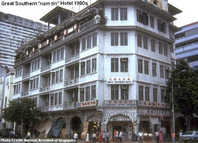
Eu Tong Sen Street, the main road to Chinatown, was nicknamed “nam tin cheng” (南天前, front of Southern Sky), referring to the Great Southern Hotel that once stood at the junction of Eu Tong Sen and Upper Cross Streets. Completed in 1936, it was the tallest skyscraper in Chinatown and was the first Chinese hotel to have a lift. Today, the hotel no longer existed; its conserved building has been converted into a departmental store called Yue Hwa.
Lai Chun Yuen Theatre (1887-1942) was a famous Cantonese opera theatre located at Smith Street before the Second World War. It was so popular that the locals named Smith street as “hee hng koi” (戏院街, theatre street). Its widespread fame also ensured the theatre was taken as the main reference for the nearby Temple Street and Trengganu Street, which were simply called “hee hng au” (戏院后, back of theatre) and “hee hng hang koi” (戏院横街, street adjacent to theatre) respectively.
It once housed many sago flour factories and, later, brothels before the early 20th century, but Sago Lane was more famous for its death houses that lined up the street until their ban in 1961. Its variant name “sei yang koi” (死人巷, lane of the death) vividly described the dreadful scene back then, where many old and sick folks were left to live out the remaining of their days.
By the mid-seventies, part of Sago Lane was expunged for the construction of the Kreta Ayer Complex and HDB flats. Some of the former funeral paraphernalia shops at Sago Lane were moved to the adjacent Banda Street.
Cheng Cheok Street, also known as “gu kar wan” (牛角湾, bull horn bay), was formerly an important crossroad at Tangjong Pagar. Its colloquial name referred to the goods-carrying bullock carts that plied their routes between the Singapore River and the wharves. The road was later expunged in an urban redevelopment project, replaced by Tanjong Pagar Plaza and its flats in the mid-seventies.
Tiong Bahru vicinity
There were many familiar colloquial names around the old estates between Bukit Merah and Tiong Bahru. The terms “ho zhui sua“, “orh kio tau“and “si bai po” easily ring a bell with many Singaporeans.
One of the first Indians to arrive at Singapore in the early 19th century, the sepoys, hired by the British East India Company, were initially accommodated in the barracks near Outram Road. The military site later became known as “si bai po” (四排坡, sepoy plain), a phonetic interpretation of the name Sepoy Lines. After the Singapore General Hospital (SGH) was established at Sepoy Lines in 1882, it became associated with the colloquial name instead.
Some elderly Singaporean Chinese today still harbour subconscious fear of “si bai po“, due to the word “si” which also means dead in the Hokkien and Teochew dialects, even though the colloquial name has nothing to do with death.
One end of Havelock Road, near Beo Crescent, used to be known as “orh kio tau” (乌桥头, head [start] of black bridge). It belonged to one group of past colloquial names that referenced after bridges. Other than Havelock and Sungei Roads, there were “orh kio” (乌桥, black bridge), “pek kio” (白桥, white bridge) and “gao tiao kio” (九条桥, nine bridges), referring to Balestier, Moulmein and Upper Thomson Roads respectively.
Queenstown vicinity
When HDB high-rise flats were built at the early housing districts such as Queenstown, Tanglin Halt, Strathmore, Dawson and Commonwealth, many were confused by their official English names. An easy way to remember the different locations was to nickname the estates according to the height of their flats.
Hence, Tanglin Halt was coined “zhap lau” (十楼, ten storeys). The former iconic Forfar House at Strathmore Avenue was popularly known as “zhap si lau” (十四楼, fourteen storeys), while “zhap lark lau” (十六楼, sixteen storeys) generally referred to the area around Commonwealth Close, Commonwealth Lane and Commonwealth Crescent.
Other “shorter” versions included “gor lau” (五楼, five storeys), “qek lau” (七楼, seven storeys) and “gao lau” (九楼, nine storeys), referring to the SIT (Singapore Improvement Trust) flats at Tiong Bahru, Redhill Close and St Michael’s respectively.
As more HDB flats were built in other parts of Singapore, the conventional naming became impracticable, and probably discontinued due to confusion.
Kallang/Serangoon vicinity
For many years, the iconic blue cylindrical tower and its incinerator chimneys at Kallang was well-known as “huey sia” (火城, fire city), a colloquial name derived from the nearby residents’ phobia that the facilities would explode. Fortunately, the fear of a fire disaster was never realised, as Kallang Gasworks produced an amazing 137 years of continuous supply of gas until its closure in 1998.
“mang kah kar“, the colloquial name of Lavender Street, has been the subject of debate for years. Was it the Hokkien translation of 芒胶脚 (foot [end] of jackfruit) or 蚊咬脚 (mosquitoes bite leg)?
Apparently, there were many jackfruit plantations near the junction of Lavender Street and Serangoon Road in the old days. Jackfruit was called nangka in Malay, but the local Chinese somehow mistranslated it into mangka. Hence, the street was coined “mang kah kar“, meaning the end of a jackfruit plantation. It had nothing to do with mosquitoes although the pesky insects were abundant in the plantations. An interesting trivia of Lavender Street was that its official name “lavender” was originally, and ironically, referring to the foul smells of night soil and fertilisers used for the plantations.
“kim jio kar” (金蕉脚, foot end] of banana) was another colourful colloquial name in the vicinity, but it was unknown whether there were large banana plantations at Petain Road in the past. It is, however, more famous as a red-light district today.
Largely known as “Little India” today, the Serangoon Road had a rather romantic name: “nam seng heu hng pi” (南生花园边, side of Nam Seng garden), which referred to the Whampoa’s Gardens, a Chinese garden beside the grand mansion built by Hoo Ah Kay (1816–1880), one of the wealthiest men in Singapore during his time.
Jalan Besar, on the other hand, was known as “kam gong ka por tai ter long” (甘榜加卜宰猪厂, Kampong Kapor pig slaughterhouse), due to the numerous pig abattoirs, situated between Desker and Rowell Roads, in the old days.
Upper Serangoon vicinity
When the colonial-flavoured estate of Serangoon Gardens was built in the fifties, the eye-catching red roofs of the early batches of houses led to its colloquial naming of “ang sar lee” (红砂厘, red zinc). The name is still commonly mentioned by the older residents today, outlasting its lesser known cousins of “zhap ji cheng” (十二千, twelve thousands) and “zhap si cheng” (十四千, fourteen thousands), both referring to the prices of the houses in the vicinity during the sixties and seventies.
Another local way of naming the places was using the milestone method, in which one milestone was approximately equivalent to 550m. This was demonstrated at the long Upper Serangoon Road, where there were “sar kok jio” ([后港]三條石, hougang 3rd milestone), “si kok jio” ([后港]四條石, hougang 4th milestone), “gor kok jio” ([后港]五條石, hougang 5th milestone), “lark kok jio” ([后港]六條石, hougang 6th milestone) and “qek kok jio” ([榜鹅]七條石, punggol 7th milestone).
The milestone method also applied to other parts of Singapore, simply using the main roads that were already in existence since the 19th century as references. Some of the examples were:
Beauty World – Bukit Timah (Upper Bukit Timah Road) 7th milestone
Bukit Panjang – Bukit Timah (Upper Bukit Timah Road) 10th milestone
Cheng Hwa Village – Bukit Timah (Upper Bukit Timah Road) 11th milestone
Chong Pang (Old) Village – Sembawang (Road) 13½th milestone
Hun Yeang Village – Tampines (Road) 9th milestone
Jalan Ulu Sembawang Village – Sembawang (Road) 2nd milestone
Jurong Village – Jurong (Upper Jurong Road) 7th milestone
Kampong Sungei Tengah – Choa Chu Kang (Road) 13th milestone
Kampong Teban – Tampines (Road) 7th milestone
Princess Elizabeth Estate – Bukit Timah (Upper Bukit Timah Road) 9th milestone
Sixth Avenue – Bukit Timah (Road) 6th milestone
Somapah Village – Changi (Upper Changi Road) 10th milestone
Teck Hock Village – Tampines (Road) 7½th milestone
Thong Hoe Village – Lim Chu Kang (Road) 13th milestone
Tua Pek Kong Kau – Yio Chu Kang (Road) 11th milestone
Tuas Village – Jurong (Upper Jurong Road) 18th milestoneMany of these names were associated with villages, and when these villages were demolished, the names also ceased to exist.
Elsewhere in Singapore
The colloquial names of places elsewhere in Singapore:
Arumugam Road (“gu cai ba“, 韭菜芭, farm of chives)
Bukit Brown (“kopi swa“, 咖啡山, coffee hill)
Chai Chee (“chai chee“, 菜市, vegetable market) – referring to the small markets selling fresh produce from the nearby farmlands.
Changi Village (“changi buay“, 樟宜尾, end of Changi)
Coleman Bridge (“tiao kio tau“, 吊桥头, head [start] of suspension bridge)
Dhoby Ghaut (“kok tai“, 国泰, Cathay) – referring to Cathay Cinema at Handy Road
Elgin Bridge (“ti tiao kio“, 铁条桥, iron bridge)
Java Street (“pah jio koi“, 打石街, mason street)
Kampong Silat (“gu kia swa“, 龟仔山, little tortoise hill)
Kandang Kerbau (KK) Hospital (“tek ka“, 竹脚, foot of bamboo)
Lorong Tai Seng (“dai seng hang“, 大成巷, Tai Seng lane)
Old Holland Road (“kek nang ba“, 客人芭, Hakka farm) – referring to the Hakka villages in the vicinity during the sixties and seventies
Ord Bridge (“tse kio“, 青桥, green bridge)
Rangoon Road (“gia dau hang“, 拿豆巷, aloe lane) – referring to the plantations of aloe in the vicinity in the old days
Seletar (“goon kang“, 军港, military port) – referring to the British Royal Air Force base and Seletar Airport
South Buona Vista Road (“gao zhap gao wan“, 九十九弯, 99 bends) – referring to the numerous bends of the road
Springleaf (“nee soon kang kar“, 义顺港脚, foot of Nee Soon port or “chia zhui kang” 淡水港, fresh water port) – referring to the flavourable deep waterways at Sungei Seletar
Telok Blangah Way (“sit lat mun“, 石叻门, Silat door)
Thomson Garden (“gor ba keng“, 五百间, five hundred houses), referring to the terrace houses in the vicinity
By the eighties, new colloquial naming of places and landmarks almost came to a stop, probably due to the government’s efforts in discouraging dialects and promoting the usage of Mandarin and English.
Some of old names can still be found today though, particularly at the hawker centres orkopitiams where they are used by the food stalls as their signature branding. A few that come to mind are the “giao keng kau you zar kueh” (赌间口油条) at Maxwell Market, “ow gang lark kok jio hokkien mee” (后港六條石福建面) at Simon Road and “mang kah kar char kuay teow” (芒胶脚炒馃条) at Ang Mo Kio Avenue 10.
All maps credited to Google Maps
Published: 28 May 2013